Detailed contact database
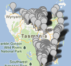
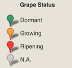
vW Maps proudly spearheaded the development of a browser-based mapping tool that visualises Tasmanian wine grapes’ susceptibility to smoke taint. vW Maps and strategic partners VineFinders and Applied Geographics created the map mashup so that authorities can plan fuel-reduction burns away from susceptible grapes. The content of the map is crowd-sourced from the growers themselves, ensuring that the map’s content is locally correct and up-to-date.
The Vines of Tasmania website was commissioned by Wine Tasmania with funding from the Tasmanian Institute of Agriculture and the Grape and Wine Research and Development Corporation (now The Australian Grape and Wine Authority).
Press coverage: New vineyard tool to minimise impacts of smoke

