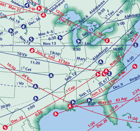
While working on a project for a magazine publisher, we learned that a scientist in California was printing maps in an inappropriate map projection and then faxing the print to the publisher. There the graphic designer would scan the fax and redraw the map in this same, highly distorting projection. The original error and the awkward transmission process severely compromised the accuracy of the final maps.
We consulted with the scientist and developed a process by which he could email the output from his software to the publisher’s graphic designer, who then imported the file into map projection software that we recommended. The result? Huge time savings, a reduction in the opportunities for introduced errors, and an attractive map showing the familiar shapes of the United States with minimal distortion.
